Holmes Dyer was engaged by the Wattle Range Council to develop their Strategic Land Use Plan.
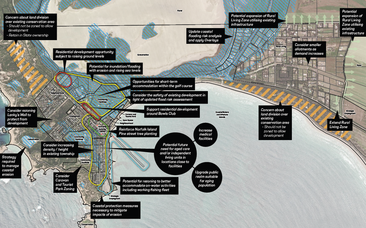
The Strategic Land Use Plan provides a 25-year vision for land use planning across the Wattle Range Council. This provides an effective and meaningful framework to ensure Council can proactively facilitate sustainable development and growth for the next 25 years, whilst also protecting valuable agricultural land and areas of environmental significance to achieve sustainable outcomes.
The Holmes Dyer team undertook a robust process of analysis and community engagement, and considered future opportunities, constraints, and issues relating to:
- Essential infrastructure and services;
- Integrated transport;
- Land supply and demand;
- Economic and development opportunities;
- Interfaces between different land uses;
- Current and future land needs and zoning recommendations;
- Community infrastructure and services;
- Environmental protection and / or enhancement; and
- Policy to manage change, growth and development.
The Strategic Land Use Plan will then inform future Code Amendments and other work by Council and the development industry to ensure that future development in the Wattle Range Council is coherent and achieves the best outcomes for the community.
Key Capabilities
- Strategic evaluation and direction
- Consultation
- Environmental issue assessment
